Layer 02 — Land-use modeling
Land-Use & Land-Cover Change Modeling
We simulate how a landscape is likely to change under different policies and pressures, so decision-makers can see the consequences of a plan before it reaches the ground.
How it works
From satellite records to future scenarios
We combine satellite-derived land-cover records with the factors that drive change on the ground — rainfall, terrain, proximity to existing land uses, and land tenure — to reconstruct how a landscape has shifted over time and where it is heading.
The same approach lets us test alternative futures. Run the model forward under today’s policy, then again under a different tenure or management approach, and compare what happens to forest, rangeland, and cropland in each case.
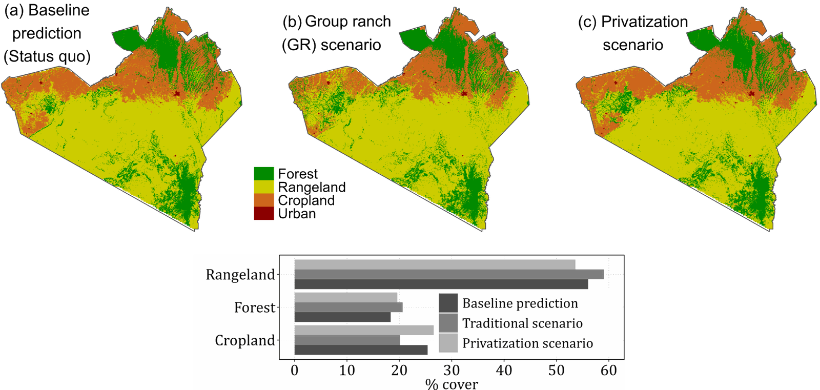
Simulated land cover under three governance scenarios for a landscape in southern Kenya. Comparing a current-policy baseline against group-ranch and privatized tenure shows how a single policy choice reshapes forest, rangeland, and cropland extent, years before it happens on the ground.
Why it matters
Built for decisions, not just diagnostics
See trade-offs before they happen
Compare how different tenure and management choices reshape a landscape, so trade-offs are visible during planning rather than after implementation.
Target limited resources
Pinpoint the zones where competing land uses are most likely to collide, so conservation, agriculture, and monitoring effort goes where it matters most.
Ground decisions in evidence
Replace assumption-driven debate with a shared, transparent picture of the landscape — useful for engaging communities, investors, and government partners alike.
Test policy before committing
Explore how a proposed tenure or governance change might play out, without waiting years to find out.
Starting point
Checked against reality
Our models are validated against observed, real-world land-cover change before they’re used for forward-looking scenarios.
→
What you get
A picture planners can trust
A forward-looking view of the landscape that has been tested against what actually happened, not just calibrated to look reasonable.
Have a landscape that needs this kind of clarity?
Tell us the policy or planning question you’re facing. We’ll tell you what the land is likely to do next.